


Here we are, about to embark on week two of Elon’s Nazi tunnel. I had worried it was just a dream, maybe a bit of undercooked potato affecting my subconscious. Is a person allowed to laugh at a Nazi boondoggle as hard as I’m laughing at this tunnel without being thrown into a camp? I even laughed at Aftyn Behn saying that this tunnel will happen over her dead body, because, ma’am, it is a tunnel. If it’s going to happen it’s going to happen under your dead body.

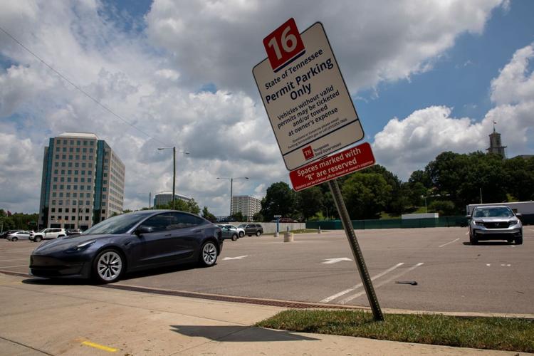
State Building Commission allows The Boring Company to use lot for construction staging
So the State Building Commission just signed off on letting Elon Musk's The Boring Company lease a downtown parking lot as a staging area for the Music City Loop project. My dog and I drove down there on Saturday, and I parked in the parking lot of the First Baptist Church, Capitol Hill to see what I could see. I had not realized that the staging area is on the far side of the church. The tunnel will seemingly have to be dug directly next to church property.
Do insurance companies write policies to protect people from a ketamine-addled Nazi with a breeding kink who wants to dig next to your church? Can someone call down to Texas to see what kinds of insurance people who live near the SpaceX launch site get? Is the Nazi tunnel going right past the front door of the oldest Black church in Nashville an intentional insult, or is this just more of Gov. Bill Lee refusing to acknowledge that Nashville is a real place where people live and things happen?
Also, property owners all along the route are going to need some way to make sure that the Nazi tunnel doesn’t encroach on their land. Who’s going to start that business, and can I invest? Ground-penetrating radar to protect you from any Nazis penetrating your ground.
There’s another thing that is startlingly obvious there where the tunnel is likely to start — it is surrounded by train tracks up on viaducts. Does CSX know that Elon is going to be shaking those viaducts from below? Is that safe? I stared hard at the makeup of the viaduct behind First Baptist, and it seems to me to basically be tracks at the pinnacle of a tree-covered berm that has short stone and concrete tunnels to let the city streets through. The basic shape is a triangle with the train tracks along the top point.
If I remember high school physics correctly, this is a very sturdy structure as long as the corners are secure. The shaking caused by the train along that top peek grows weaker as it spreads through the berm. Think of how big a splash you can make by throwing a rock in the water. But then think of how small the ripples at the shore are going to be. Even with the top point vibrating from the train passing along, the bottom two points remain in place because the shaking’s impact dissipates through more and more of the structure. Basically, it gets absorbed by the stone and the soil. If you had a regular drum and a drum filled with dirt, you’d find the regular drum much noisier, because the vibrations are traveling through air and not being muffled by dirt.
But what happens when it’s the bottom of the triangle that begins to shake? When it’s the foundation of the berm? In a fight between the railroad and Elon, who would win? (And if we do get lawsuits flying, can I title my column about it “Jere Baxter Has His Revenge on Nashville,” or is that reference too obscure?)
Here's the last bit about that location that I know and anyone who was here for the 2010 flood should suspect. There’s a creek there. I found a map ... crap. Can I say where I even found this map, or will the place that holds said map be forced to burn it and remove all traces from the internet because it’s helpful and contextually funny? I can’t risk it. This place has been too kind to me too often throughout the years.
Who would I like to see get in a little trouble? Hmmm. OK, I’ve got it. I found this map at a treasure of an institution near Cameron Sexton’s office. Before I clicked on the link, I shouted, “Cameron Sexton, tell me not to look if I’m not supposed to look!” and then I listened real hard and didn’t hear anything from him. So Cameron Sexton practically gave me permission to show you all this map. For all we know, he loves this map too.

"Davidson County, Tennessee, 1871," by Wilbur F. Foster
It's Wilbur Foster's 1871 color map of Davidson County (the version at that link is much higher resolution), which I probably look at four or five times a week. If I had to name a favorite map, it’s this one. But today what we’re going to do is look along the proposed tunnel route. First Baptist is on Gay Street with Rosa Parks Boulevard right in front of it. The train tracks curve behind it. A lot has changed since Foster’s day, but we can still use Gay Street as a landmark, as well as the train tracks. The H in "Nashville" is right next to the block where the current First Baptist is.
Remember, First Baptist is south of Gay Street. Look at the block north of Gay Street. See that squiggle in the corner of the block? That’s Lick Branch. I usually hear it referred to as a creek, but that could be selling it short. One branch of it runs from Centennial Park through that whole Charlotte Pike area. Here’s another Wilbur Foster map from the 1870s that shows the creek very clearly, and it shows the train tracks in slightly different relation to it. You want another, more modern look at Lick Branch? Check out FEMA’s flood map. When we get another flood like the one we had in 2010, the entrance to the tunnel will be underwater.
Y’all thought I was kidding about needing those old round rafts from Opryland as our backup way to navigate the tunnel, but we could have a Nazi River Rampage here — better that we’re prepared to float to the airport on a white water adventure than get stuck with a bunch of drowned Teslas.
This is not the only creek that the tunnel will seemingly need to go beneath. Wilson’s Spring Branch, depending on what map you’re looking at, either runs from Wilson’s Spring (about where the Eighth Avenue roundabout is) or farther. This is the creek that ran through Black Bottom. It’s the creek that still sometimes floods basements in SoBro. FEMA’s map also shows the potential for massive flooding along Brown’s Creek, which Murfreesboro Road crosses near Mt. Ararat Cemetery, and Mill Creek.
But if you look at either of Foster’s maps out along Murfreesboro Pike, you’ll see that before you even get to Mill Creek, there is an offshoot of Mill Creek that runs right along Murfreesboro Pike. Judging by the curve of the railroad and the direction of the pike, I think this creek — which is likely now underground — like Lick and Wilson’s Branch, runs along Murfreesboro Pike before Spence Lane.

Perhaps this will be a grand boondoggle that we’ll all get to witness and take delight in, for free
First Baptist is at about 450 feet above sea level. If we assume that the tunnel will be at the same depth as the Vegas tunnel, then the tunnel will need to go down to 410 feet above sea level at that point — but when it gets to Brown’s Creek, that’s only 430 feet above sea level. If we’re going to stay 40 feet below the surface, then the tunnel needs to be at 390 feet above sea level. But here’s my favorite part: Mill Creek at Murfreesboro Pike is at 450 feet above sea level. The airport is at 570 feet. So, assuming the plan is to keep the tunnel 40 feet below ground until it needs to surface, Tesla cars will need to climb 160 feet between Thompson Lane and the airport. That’s a 20 story building!
To be clear: This tunnel doesn’t just have to go through rock, it needs to go under water. It needs to not shake down First Baptist or the railroad tracks. It can’t encroach on any of the properties along Eighth Avenue, which is a very tight space, and it needs to be far enough underground that it’s not disrupting utilities or encroaching on the foundations of nearby buildings. The 10 miles of rock they take out has to go somewhere. Does anyone know what the plan for it is? And how deep is the tunnel going to have to go? And yet I’ve seen a bunch of people credulously reporting that this could be finished by 2027.
Oh, this is the best. This is a public debacle basically custom-made for me. I swear, if that drill gets stuck under one of those creeks, I will switch my religion to creek worship. How soon can they start digging?