
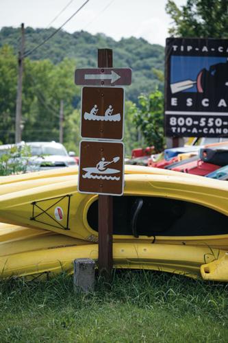


According to the state, Tennessee is home to about 17,000 miles of warm-water streams and rivers. Many of the rivers here in Middle Tennessee, most of them within a couple hours’ drive of Nashville, are popular destinations for kayaking, canoeing and innertubing, dotted with rental sites that offer all the necessary equipment. See our appraisals of five of them below.
Buffalo River
Nostalgic, wild, quiet
Forgive me for having a soft spot for the Buffalo. The Middle Tennessee Council Boy Scouts of America operates Grimes Canoe Base halfway between Linden and Topsy (seriously), so the Buffalo was the first “wild” river I ever floated nearly 30 years ago. One trip there, my troop awoke to see a very large and unbothered raccoon sitting in a Dutch oven, holding its cast iron lid in one paw and scooping cobbler detritus into his mouth with the other. That doesn’t really have anything to do with the river, but it’s a fun story.
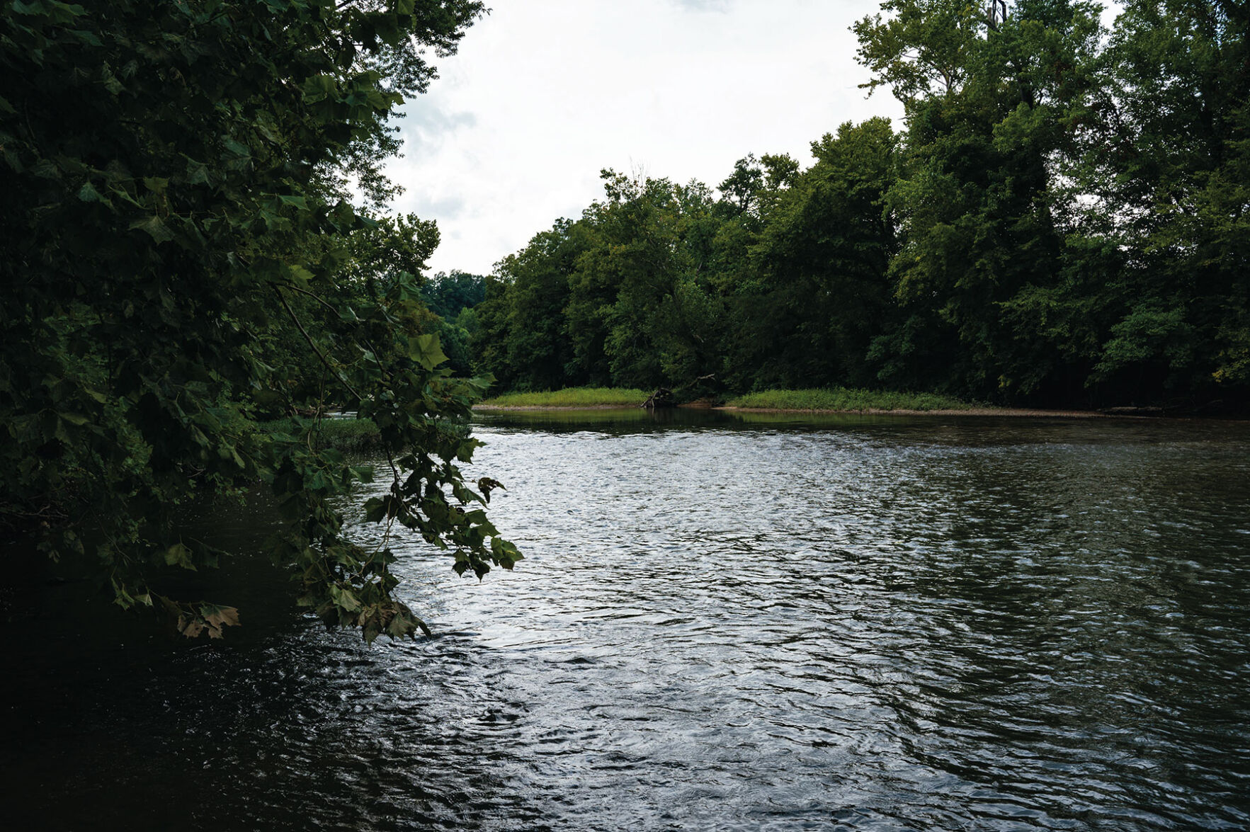
The Buffalo is the largest tributary of the Duck (more on that below) and flows unencumbered for 125 miles. Its middle section — primarily in Perry and Humphreys counties — is the primary target of the paddle crowd. If it’s good enough for the Scouts, it’s good enough for you.
Like its big brother the Duck, the Buffalo is prone to rising water in the wet seasons and is similarly biodiverse, so aim for the autumn. There are outfitters available in Linden and Lobelville, and certain stretches of the river are also suitable for tubing.
Because much of the river is on protected land, it can be a fairly wild trip, with low-hanging branches coming from above and alligator snapping turtles coming from below. (I highly recommend a good pair of rock-fighting water shoes.) But other than the occasional Scout troop, it’s often fairly empty and quiet even at busy times. Just don’t leave your cobbler unsecured if you camp overnight. JRL
Cumberland River
Large, ominous, beckoning
Engaging with the Cumberland doesn’t have to be scary, difficult or a health risk, though many Nashvillians intuit (correctly) that nothing that close to Broadway is safe for bathing. There are plenty of reasons to be interested: It’s close to your house, or you’ve been to Austin where people swim downtown, or you feel that, in the hottest stretches of the summer, it spites you a little bit more every day. The city, developers and the Tennessean have (together) been trying to make the Cumberland “happen” for a couple years by reframing the river as a primary city asset. A few of us even have that friend who (allegedly) dips in the Cumberland regularly. The best information says it’s complicated.
Metro is 16 years downstream of an EPA consent decree that requires quarterly reports on the city’s sewage runoff, much of which drains into the Cumberland — Metro Water reported about 12 million gallons of sewage runoff in April, May and June. The Cumberland River Compact’s 2019 water-quality overview cites runaway runoff and pathogenic E. coli in and around the Cumberland’s downtown bend. For a safer and cleaner approach, head upstream and stay rural. Historic Granville, home of the much-advertised Wildwood Resort and Marina, has a welcoming downtown and a nice riverside park. EM
Duck River
Lengthy, diverse, rewatchable
Winding 284 miles from its source between Manchester and Murfreesboro to New Johnsonville where it flows into the Tennessee, the Duck River is the longest river wholly within the Volunteer State. Its superlatives don’t stop there: It’s also considered the most biologically diverse river in North America, particularly well-known for its wide variety of mussels, many endangered. It was environmental concerns that kept the Tennessee Valley Authority from finishing Columbia Dam after a critically endangered mussel was found in the area.
The Duck is fairly serene. There are a few small dams creating reservoirs for the towns that rely on the Duck for drinking water, in addition to the TVA’s Normandy Dam near Manchester. Navigation can be challenging, as the Duck winds and bends and splits, giving paddlers fits as they have to decide which way around a gravel bar to go. It’s also prone to quick rises, especially in the spring and early summer, but that just means it’s best to delay floats to the early fall, when the leaves begin to turn and the vast array of wildlife is easily spottable and moving about. Otters are a not-infrequent sight.
There are some decent little drops and rapids as the river comes off the Highland Rim and into the bottomland, but nothing that even a moderately experienced canoer or kayaker would balk at. The Duck River Agency in Shelbyville provides river maps and conditions and is a good stop for folks looking to set out on their own, but there are also plenty of outfitters for day-trippers. With all those miles, a completist could take dozens of trips without repeat. JRL
Harpeth River

Accessible, social, convenient
Sound logistics and a social atmosphere make the Harpeth ideal for entry-level river enjoyers. The river loops back on itself, allowing for convenient pickup and drop-off locations and a wide array of float times. Kids, even young ones, will remain emotionally intact thanks to shorter floats (crafty navigators can find two- and four-hour routes) and plenty of pebble beaches perfect for pit stops. Chillers with coolers can float the whole day. A popular route takes floaters a leisurely two miles, from a parking lot launch right off Highway 70 to the Harpeth River Mound Bottom. A micro-rapid halfway through provides just enough excitement.
Some of the fun comes from arguing with friends and family over how to best piece together a flotilla of interchangeable inflatables (a little rope goes a long way), though nearby rental outfits offer sturdier vessels. The Harpeth runs year-round, but be wary later into the fall — cold floats aren’t fun, and the water flows only one way. EM
Red River
North, silty, historical
Like the Buffalo and Duck, the Red River is a Davidson County day trip. Unlike its peer mid-grade tributaries, the Red is north and close to top-tier off-river attractions, offering a trip both rugged and refined. The river itself presents plenty of on-water obstacles, and it demands closer attention to navigation — more of a canoe-and-kayak adventure than a float. The banks and water are murky and opaque, rich in minerals that give silt its color and the river its name. Launch infrastructure is a little more sparse than it is on the Harpeth or the Duck, but access points dot the river between Clarksville and Keysburg, where the Red meanders into Kentucky.
To round out a day-trip float, the Red takes passengers on a journey through Tennessee history. Near Adams, it brushes up against the legendary Bell Witch Cave. In Port Royal State Historic Park, travelers intersect with a somber waypoint on the Trail of Tears, the forced removal of Indigenous people from the Southeast. The Red comes with more isolation, fewer crowds and a more mature river profile. EM

Five nearby destinations for the perfect weekend getaway — plus details on five Middle Tennessee rivers for your upcoming day trip


